
R for Remote Sensing
Dates
10-13 November 2026
To foster international participation, this course will be held online
Overview
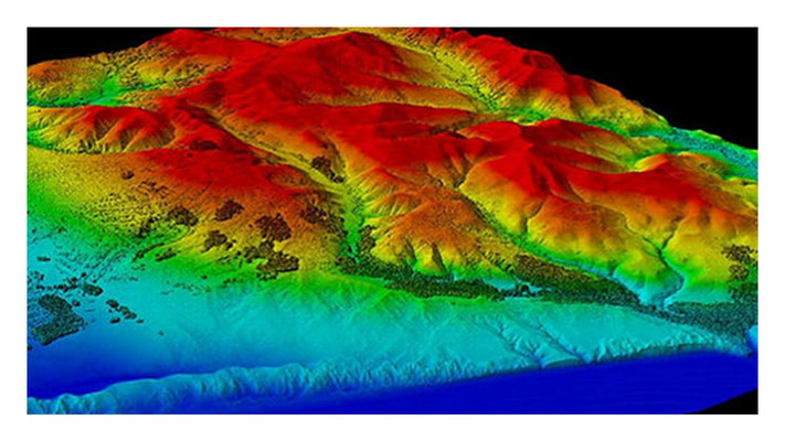
This course introduces participants to using R for remote sensing, focusing on practical workflows in R to generate analysis-ready data with multispectral, hyperspectral and lidar data. Remote
sensing data and approaches are used in many contexts and applications, and this course is biased towards forest contexts and ecological applications. That said, this course offers a foundation
in remote sensing theory and approaches that can be generalized for other purposes. This course includes lectures, discussions, demonstrations, and hands-on coding in R.
Each day builds on the previous, and we will cover the fundamentals of remote sensing, the R spatial ecosystem, quality assessment, preprocessing, data exploration and feature extraction, and
classification and information extraction. By the end of the course, participants will be able to:
• Navigate the R ecosystem for spatial and remote sensing data
• Import, export and visualize multispectral, hyperspectral and lidar datasets
• Use metadata and exploratory analysis to assess data quality and structure
• Preprocess to correct errors
• Derive spectral indices and/or structural metrics
• Perform basic classification and information extraction
• Produce reproducible analysis-ready datasets
Learning outcomes
The course is targeted to researchers who would like to learn how to use R for remote sensing data. Participants should have a basic knowledge and comfort with R and R Studio/Posit. Familiarity
with remote sensing data or workflows is not essential.
Prerequisites
Those thinking of taking this course should have a minimum aptitude with the R. Beginners and those unfamiliar or uncomfortable with R are discouraged from attending as this may impede your
ability to make the most of the course.
Program
Daily schedule: 12 - 4 PM (Berlin time)
Day 1: Intro to Remote Sensing and the R Spatial Ecosystem - 12 - 4 PM (Berlin time)
Theory:
• Introduction to spectral and structural remote sensing
• Scale: spatial, temporal, spectral, radiometric, thematic
• Data models: raster, vector, point-cloud
• Introduction to the R spatial ecosystem
Practice:
• Import multispectral and hyperspectral rasters and lidar point clouds
• Inspect (bands, resolution, extent, point density), visualize (band images and composites), and summarize (data attributes and structure)
• Quality assessment
• Export subsets and intermediate products
Day 2: Preprocessing Remote Sensing Data - 12 - 4 PM (Berlin time)
Theory:
• Errors (geometric, radiometric) and common quality issues in remote sensing data
• Preprocessing steps across remote sensing data types
• Data-specific, temporal, and data fusion considerations
• Understand impacts of preprocessing choices
Practice:
• Basic functions (crop, reproject, mask, resample)
• Error correction approaches
• Noise and dimensionality reduction
• Assess preprocessing outcomes
Day 3: Exploration and Feature Extraction - - 12 - 4 PM (Berlin time)
Theory:
• Exploratory data analysis and feature space
• Feature identification, derivation and extraction
• Common derived products (e.g., vegetation indices like the Normalized Difference Vegetation Index: NDVI)
• Temporal consideration: differenced products
Practice:
• Spectral feature extraction
• Structural feature extraction
• Land use landcover (LULC) change
• Visualization and interpretation of derived features
Day 4: Classification and Information Extraction - 12 - 4 PM (Berlin time)
Theory:
• What is “analysis-ready” data?
• Scale, revisited (e.g., ecological realism and remote sensing scale)
• Types of classification (e.g., supervised versus unsupervised, fuzzy versus hard)
• Accuracy and uncertainty
Practice:
• Classify lidar and multispectral data
• Assess and compare classification performance
• Extract summary statistics
• Export maps and tabular outputs

Instructor
Dr Rachel Jade Kuzmich, Norwegian University of Life Sciences, Faculty of Environmental Sciences and Natural Resource Management.
Rachel has a background in geography and biology. Her research uses remote time series to understand forest change.
COst overview
Related courses
1 - Interactive Maps with R - ONLINE, 13-14 May
2 - Functional Trait Space Analyses in R - ONLINE, 14-16 September
3 - Design, implement and promote species monitoring in R - ONLINE, 12-14 October
4 - Marine Spatial Data in R - ONLINE, 3-6 November
Cancellation Policy:
> 30 days before the start date = 30% cancellation fee
< 30 days before the start date= No Refund.
Physalia-courses cannot be held responsible for any travel fees, accommodation or other expenses incurred to you as a result of the cancellation.